 70 and one quarter miles over 9weeks; From St Helens on Merseyside to Thornton-in Craven on the Lancashire-Yorkshire border. Nine walking days (Sundays including one Saturday I think) with stunning views over Lancashire and the Cheshire Plain ending with a gradual climb to Pendle Hill with unsurpassed scenery all round. Meandering streams, leafy lanes, hidden pastures, reservoirs, canal towpaths and woodlands. The view can be changed by clicking on Road or Aerial as shown. You can zoom in and out of maps by using the toolbar or, I prefer, using the scroll wheel on your mouse (assuming you have one). You can also move around the map by clicking and dragging.
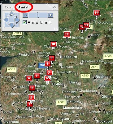 http://local.live.com/?v=2&cid=A379F4C664F7684F!578 provides you with a link to the overview of the Lancashire Trail; didn't we walk a long way!
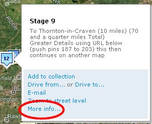 Hovering over 'pushpins' provide images (if I've added them) and More details; This will open other maps with step-by-step directions. Photographs taken on the Trail are available at http://www.flickr.com/photos/acljohn/sets/72157594231686898/
Other links to maps: if you want to look at them individually, are...
http://local.live.com/?v=2&cid=A379F4C664F7684F!108
http://local.live.com/?v=2&cid=A379F4C664F7684F!310 and
http://local.live.com/?v=2&cid=A379F4C664F7684F!517
Watch this space for the next walk...
No comments:
Post a Comment