Monday, May 26, 2008

Sandstone Trail Revisited...

Today we had company on our walk, Mandy and Dave had come to visit over the Bank Holiday weekend. Chris and I walked the 34-mile (55km) Sandstone Trail some years ago so it was quite nice to revisit the first leg of that walk.
Parking in the small car park on Beacon hill we set off on our 5.7659 mile walk. The sandstone ridge bounds the western edge of the Cheshire Plain. At Frodsham and Helsby it breaks out into real crags. (It does at Beeston as well but our walk didn't go that far this time). Both hills form the classic escarpment; the sandstone strata slope gently down to the south east, while the craggy fronts face the River Mersey.
You can see where we walked at http://www.gmap-pedometer.com/?r=1929813.
An interesting walk including crossing a golf course (officially, as the path is older than the course, walkers have priority but we didn't take it for granted), passing Woodhouse Hill (there was once a hill fort there; iron age) now owned and managed by the woodland trust, down (and later up) Jacob's Ladder with well worn footholds carved in the rock, and through the outskirts of Helsby before assending Helsby Hill.
Views of the River Mersey, both Liverpool Cathedrals, were glimpsed through the trees and almost at the end of the walk when we reached Frodsham's War Memorial on top of Frodsham Hill.
Ramblers
This picture was added using Mbedr, which if it works allows me to add flickr images while retaining any annotated regions present on the original. If you want to try it out then go to http://www.elsewhere.org/mbedr/.
Just before reclimbing Jacob's Ladder I spotted a Tawney Owl flying through the woods and out into a tree in an adjacent field. Sadly not time to take a photograph.
We took the advice of the guide and went to the Helter Skelter, on Church Street for refreshments. Apparently named after the centrepiece of the fairground which used to stand on the hilltop; the outside and public bar were far from inviting but we made our way up to the restaurant and found that the food and beer to be excellent; the choice of cask ales made me wish that I wasn't driving (I did enjoy a pint of Shropshire Gold. Don't be put off by appearances!
Blogged with the Flock Browser
Monday, May 19, 2008

Anglezarke and Round Loaf

A 7.5339mile walk starting from the carpark beside Anglezarke Reservoir; the walk took us up through Lead Mines Clough, stopping briefly at a World War 2 Memorial. The monument commemorates the crew of a Wellington Bomber which crashed at this point, returning from a mission.
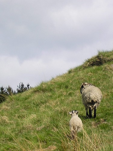
It was then up onto the moors along with many ewes and their lambs...
I'm following mum!
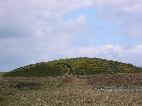
...to find Round Loaf, an ancient burial mound...
Notice the cotton grass
Even from a distance this tumulus, with cotton grass sprinkled across the moor, was impressive. As we got closer it was obvious that paths radiated from it (converged to it) in all directions of the compass...
Round Loaf
The view from the top of Round Loaf was, on this clear day, spectacular.
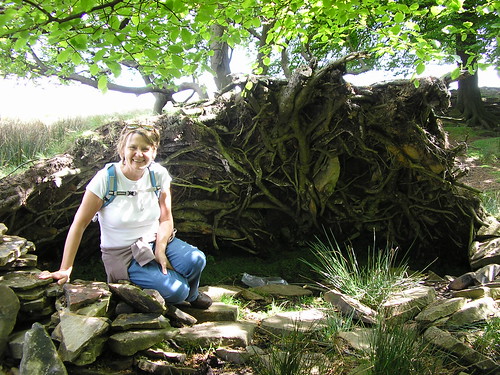
It was the off the moor along Dean Black Brook. One fallen tree's root system, by the look of the remains of man made structures, had obviously been used to provide a bivouac or a sheep shelter...
Bivouac or sheep shelter
The path dropped down through some narrow gorges between ridges of moorland...
Dean Black Brook
Local residents seemed determined to eat in the most dangerous of places...
It is always greener...
Once down off the moor we arrived at White Coppice, with its cricket field and small reservoirs...
White Coppice
We walked along "The Goit" to arrive at a road near "Waterman's Cottage".
First mistake for some time. The guide said "...look at the waterfall and then continue by crossing the road and entering the woodland, to follow a path along the right shore of Anglezark Reservoir." Silly me I didn't look at the map; what the instructions should have said was keep the reservoir on your right! We went the wrong side! never mind, it only added an extra 1.3 miles to the walk.
We has been promised water fowl on the reservoir but only a few mallard, a grebe and the highlight, Geese and gosling...
The young are there, honest
All in all, thoroughly enjoyable walk.

Blogged with the Flock Browser

Saturday, May 17, 2008

Parbold-Hilldale-Fairy Glen

It is just over a year since we last did this walk and you can read about that walk at http://maghullmeanders.blogspot.com/2007/04/parbold-hilldale-fairy-glen.html.
The map for the walk is at http://www.gmap-pedometer.com/?r=904614.
Chris worried about climbing Parbold Hill and when I told we didn't have to, she wasn't convinced. We didn't but every hill we climbed she counted, coming to the conclusion that Parbold Hill may have been less daunting.
Just before Hilldale we passed a small holding with what can truly be described as free-range fowl...
Image of cock
We stopped for a pint on the way (at the top of one of the many small hills) and enjoyed a Timothy Taylor's Landlord. The menu looked good so we decided to go there next Wednesday, after shopping, for a meal. I'll let Chris write about the meal in her blog.
The main reason for repeating the walk was to see the bluebells...
Bluebells in Fairy Glen
As you can see they we coming to the end of the season. Nice all the same.
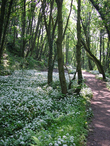
The garlic was detected before it came into sight...
Garlic flowers
Bluebells in Fairy Glenand in a shady part, a fine specimen of bracket fungus was spotted...
Bracket fungus
As before an enjoyable walk, a welcome pint, a nice picnic and excellent weather (a little hot if anything).
Blogged with the Flock Browser