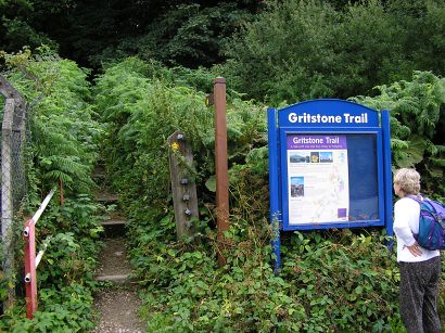
 If I had known how I was going to feel at the end of the day, when we set off on August 16th 2006, I’m not sure I would have agreed to walk the Gritstone Trail. It wasn’t so much the distance, both Chris and I walk regularly at the weekends, but the uneven paths and the ups-n-downs. To say my feet suffered is an understatement.
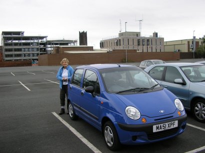
To be fair we started later than planned having deposited one car at Tegg’s Nose Country Park (£1.50 per Day) and the driven to Disley Station where the Trail starts. Chris made use of the ‘tardis (Time And Relative Dimension (or Dimensions) In Space) facilities’ and we set off walking up the steps through the wood to Red Lane where we turned right and then left into Green Lane (Perhaps Disley should be more aptly described as ‘colourful’ than ‘attractive’).
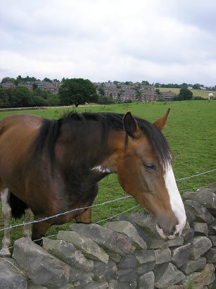 We were heading for Lyme Park (Lyme, we gather meaning border country). The first landmark, on a hill, was identified as The Cage, an early 18th century hunting tower. A brief stop to provide an extra-strong mint to a local equine and we continued towards Lyme Park. In the distance we could see Sponds Hill, we would be walking along that ridge later in the day, and the Cage continued to get closer.
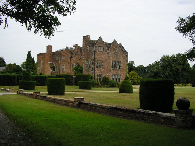
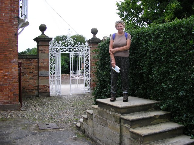
Entering Lyme Park by the East Lodge, we were informed by signage that the Park was owned by the National Trust and that we were in a Deer Sanctuary. Sure enough in the distance, well camouflaged, were red deer apparently descended from the ancient herds that roamed the hunting forest of Macclesfield. Chris was sure that Lyme Park had been used in the film of Pride and Prejudice; again this was confirmed by signage in the car park. Following the way marks up through woodland, with deer visible to our left (red deer as well as, what appeared to be, roe deer and some that were completely white).
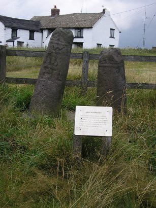 Crossing open fields we made our way up to a ladder stile and to a road along the ridge.
We took a brief detour to look at the Bow Stones; remains of Anglo Saxon crosses marking the edge of an ancient kingdom. Presumably the Lyme (border country) was bordering this kingdom.
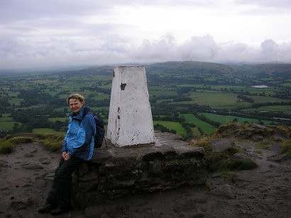
Returning to the main Trail we continued along the ridge to Sponds Hill, the highest point on the Trail at 1332.5 ft (410m). The views were quite something, well worth the climb! Some walkers were encountering problems in the form of two dogs who, apparently, were roaming on their own but very pleased to see humans; this consisted of lots of tail wagging and jumping up! Needless to say Chris was not impressed especially when the larger dog decided to jump up at her and leave a muddy paw print on her white T-shirt! Thinking we had escaped the jumping etc., when we crossed the stile, Chris was much happier! A short lived happiness, as both dogs seemed to enjoy our company and found a way over the fencing. Chris spent the next stretch of the walk keeping me between her and the dogs. They were well behaved but I think it fair to say Chris did not enjoy their company as much as they enjoyed ours.
We left the dogs when we joined the Bakestone Road, either they couldn’t find a way over/through the fence or they were fed up with Chris trying to keep as far away from them as possible.
The road, I found out later, got its name from the bakestones which were quarried in this area; used for baking cakes over an open fire. (Alfred the Great springs to mind!)
It was during this section that I took a wrong turn; note I admit it was my error! Everything was fine when we took the footpath on the left after Brink Farm but, somehow I managed to take a wrong turn and end up on Bakestondale Road. Looking at the A-Z map of Cheshire later this added about another 3 miles + (4-5 km) to our walk; on the road through Pott Shrigley until we re-joined the Trail at Oakenbank Lane. We did pass the ‘Black Bear Park’ but no bears were apparent! I was very annoyed with myself, especially as my gut feeling was that we had headed in the wrong direction, and I should not have gone wrong. Just over ten miles for the first day was OK but now it was going to be thirteen or fourteen miles, damn!
Never mind there was a pub at White Nancy where we could top up our fluid and have a very late lunch!
By the time we reached the step to go up to White Nancy my feet were very sore and I had no doubt that blisters had formed! However just down the hill was alcohol and food! Oh no it wasn’t a pub, it was now a private house; there was no alcohol, no drinks of any type and, of course no lunch! Another big error on my part; I had not eaten at all and we had only one bottle of water which was empty! Chris, who had had breakfast and was in far better condition, set off down the hill to the village to find a shop. She returned quite quickly with a refilled bottle. She had spoken to a local woman to be informed that there were no shops and the nearest pub didn’t open until five o’clock. She filled the water bottle for us.
 Feeling quite low we headed back up the hill, up the steep steps to White Nancy; built in 1820 by the Gaskells to commemorate the Battle of Waterloo.
The path along Kerridge Hill was one off the high points of the first day. A good path, wonderful views and a nice rest from the previous ups-n-downs.
The less said about the final stretch the better! Harebells and Heather brightened the walk but the number of small climbs and then, even worse for the feet, descents nearly finished me off! The final climb up to Buxton Old Road and Tegg’s Nose Country Park was nearly the straw that broke the camels back! If the rest of the walk is going to be like this I’ve serious doubts about continuing!
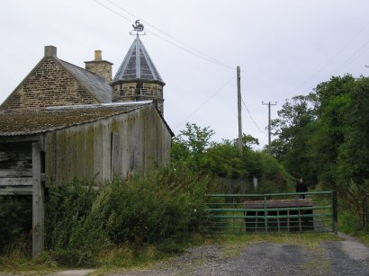
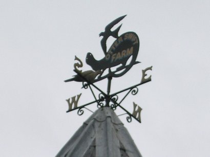
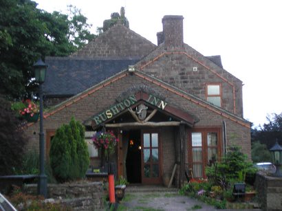
Chris drove back to Disley and then with both cars we headed for our ‘Base Camp’ at the Rushton Inn, at Rushton Spencer on the A523. Down came the rain! Stair rods is the best description and one used several times during the evening.
Isn’t it amazing what a shower, a few pints, a large whisky and food does for the whole body.
Lynn and Frank, our hosts, were very welcoming and Lynn took us up to the first floor; all ours apparently! Large landing complete with grandfather clock, two bedrooms, one with two single beds, tea/coffee making facilities, TV and easy chairs (rocking); the other had a double bed; a large bathroom with shower, corner bath, sink, toilet etc. After a shower and change of clothes, yes I have blisters (between the toes and ball of my feet) we headed down to top up our fluid levels (Flowers Brewery) and to have a meal. Sweet & Sour Chicken for me and Cajun Prawns for Chris. This turned out to be surprise Cajun Prawns as it was Cajun Chicken. Frank failed to read Lynn’s order! However Chris said it was very nice. Frank promised to look after her the next evening.
 Day Two…
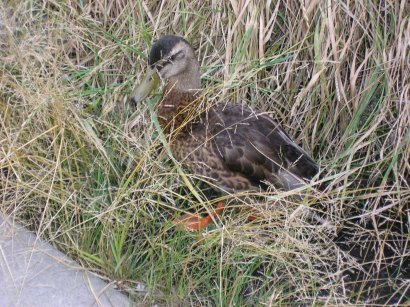
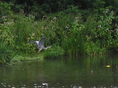
Tegg’s Nose to Base Camp. The middle section should go to Timbersbrook but I persuaded Chris that by returning to the pub we only needed to use one car initially. The weather forecast wasn’t promising but with any luck we would be OK. Before you wonder, today was a positive pleasure compared to the first day. I think we paced Day Two much better and after a full breakfast and stocking up with food and sandwiches from the Co-op we arrived at Tegg’s Nose Country Park. Curves of Gritstone in the quarry face plus information plaques and machinery enabled us to take a closer look at how the rock was laid down over 250 million years ago and how it was ‘worked’ by man. The Trail drops from the summit 1235 ft (380 m), through woodland to Bottom’s and Tegg’s Nose reservoirs; built in 1850 and 1871 respectively. They were built, not to conserve water but to provide a steady flow down the River Bollin to power the mills of Macclesfield. As during our walk last week, we saw herons (x2) and Grebe (1 adult and two young). In the distance we saw the telecommunications tower; we will walk past this later today; I’m not sure that this helps as it appears a long, long way away! Looking back however, makes you realise how far we have already walked. I managed to keep us on track today and we had elevenses just beyond Meg Lane. I later found out that Meg Lane End was home to ruthless highway men who stalked the lonely hill passes to rob weary travellers! I’m not as weary as yesterday but probably a good spot to choose. The Trail was well signposted and in no time we were going up Foxbank onto Croker Hill; 1306.5 ft (402 m).
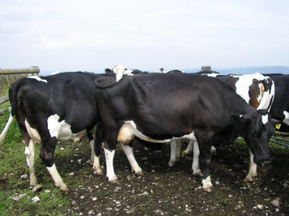 Cattle Alert! To pass the telecommunications tower we had to ease our way through a herd of cows, who for some reason found standing in front of the only stile was a must! Chris, as with the dogs yesterday, kept me between her and the cattle and was over the stile with such speed that belied the tiredness she had claimed she had in her legs. Passing the tower and heading down towards the A54 we made excellent time and soon stopped for lunch in Minn End Lane. Food, water and warm sun; both of us were tempted to have a snooze. Resisting the call of a nap we headed off along the Minn to Hawkslee; and excellent road/path and when looking back we were encouraged by how far we had travelled since our lunch stop.
The sky indicated we were likely to be in for some rain; it just depended upon how far we could get before the heavens opened. The decent into Shell Brook Valley was very hard on my sore feet but it could have been far worse; so far today has been a positive pleasure. I’m sure that a full tum, more fluid and a less strenuous Trail has helped. As we climbed up out of the valley it started to rain. Waterproof jackets on we headed for Barleighford Bridge where the Trail crosses the River Dane; Shell Brook is a deep pretty valley and may well be worth another visit when it isn’t raining.
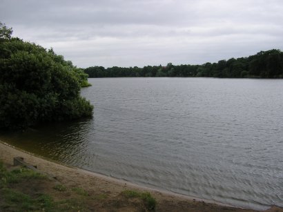
 When we reached the canal feeder (goes into Rudyard Lake and eventually supplies the Caldon Canal at Leek) at Barleighford Bridge the thunder and lightening arrived as well; stair rod rain pounded our hoods/hats and we had to push our way through tall undergrowth; this resulted in a ‘good soaking’; Chris was so glad we had decided not to go on to Timbersbrook! We reached the A523 and after a short, but very wet, walk up to the pub we removed the outer gear, got into the car and returned to Tegg’s nose to get my car.
Bath, a change of clothes and a hot drink set us up for the evening. A few beers, Fish-n-chips for me, scampi-n-chips for Chris (tarter sauce Mmmmm) and a large whisky, finished off what had been a much more enjoyable day (rain excluded); distance completed about 10 miles (17 km).
 Day 3
Day 3Rushton Spencer to Kidsgrove (further than originally planned, as we did less yesterday); The weather forecast is terrible; during breakfast both Lynn and Frank were telling us how bad the day is going to be! In the porch, as we leave, we find a ‘racing-pigeon’ sheltering from the rain! Who has more sense, the pigeon or us? Stair rods again as we go to Kidsgrove to drop off my car at the end of todays walk. We are fully dressed for all the heavens could throw at us; waterproof everything, well almost everything. First stop Tesco for supplies that include sandwiches and water. The telecommunications tower we walked past yesterday was shrouded in clouds and things didn’t look to good for the walk ahead. By the time we got back to the pub, the rain had eased to just a few spots; down the hill to rejoin the Gritstone Trail as we head up the Cloud 1114.75 ft (343 m);
 some climb, especially with sore feet but I am determined to complete this walk. The first part took us through mushroom covered meadows to Raven’s Clough; on and upwards through woodlands (Chris had to remove garments from under her waterproof as she was too hot) to the road. Against all odds the sky has cleared and it is getting increasingly hotter; I wish I’d brought my hat (I had expected to be wearing my rain-hood all day). Continuing along Cloudside we eventually reached steps and a path to the top of the Cloud.
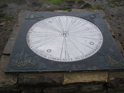
 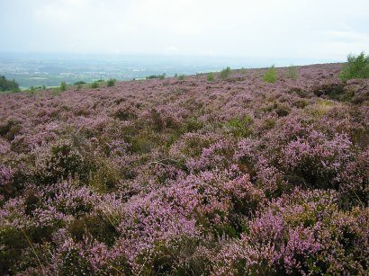 Heather in full bloom, wonderful views and a day that was getting warmer and brighter. Chris was pleased that we didn’t do this stretch last night in the rain! After some discussion at the trig-point we chose the correct path down the hill to Gosberryhole Lane, then down some significantly high steps to Tunstall Road and to Timbersbrook Picnic Area (once the site of a large silk mill and dye works). Elevenses and off again with water-proofs now tied around the waist! So much for the rain! We just have another nine and a third miles to complete the Trail (15 km). Mainly field crossing, at the start of this section of the Trail, up to the Biddulph Valley Way (an old railway line which carried sand from Cheshire to the Potteries and coal back to Congleton); just before leaving the Biddulph Valley Way, we stopped for lunch. Refreshed we went down some steps and back under the bridge towards Nick i’th Hill (believed to have been a melt water drainage channel in the last Ice Age).
 Chris got her own back on the local cattle by making silly noises as we walked under the bridge; they looked in shock as we emerged!
Eventually, after plums found in the hedgerow, we reach the final ridge where the Trail follows part of Congleton Edge, formed as part of the ‘Red Rock Fault’, apparently the much older and often harder rocks of the Peak District and Pennines dip beneath the younger sandstones and mudstones of the Cheshire plain. Patches of white clay could be seen, once used for pots and clay pipes. It was so hot by now that waterproofs were removed completely. Where was all this rain we were promised?
 The walk up Congleton Road was the low point of the day and it was a welcome change to turn off through the woods to pass the Old Man of Mow. A Gritstone pillar over 65 ft (20 m) high, left standing as the stone around it was quarried away.
 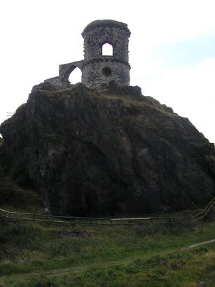 Mow Cop was the next port of call; perched on top of an outcrop of millstone grit, it was built in 1754 by Squire Wilbraham to improve the view from Rode Hall.
We now headed down towards the Macclesfield Canal and the final stretch into Kidsgrove. Then the added bonus of the week; the Post Office was open and with new bottles of water and ice-pops we built up our energy for the final walk home. The footpath, at the side of the chapel was the most uneven path of the whole trip; playing havoc with feet that had stood up reasonably well today. Apart from that one drawback the rest of the walk to the canal, along The Brake (part of an old tramway which carried coal down to the Macclesfield Canal) was uneventful.
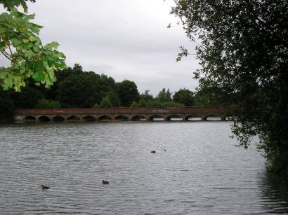
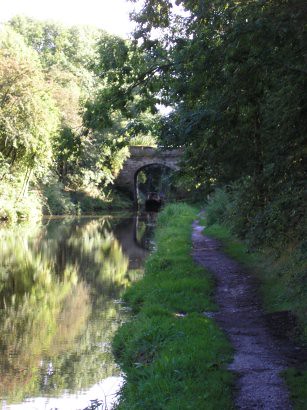 The canal section was mainly in the shade, which was a blessing, as I was hatless and wasn’t prepared to tie knots in hankies. At the lock a young rabbit totally ignored us as it obviously decided we couldn’t jump the lock. A well maintained towpath meant we made excellent progress to Red Bull where we turned right down the stairs before the aqueduct and left along the towpath of the distinctly ‘red’ Trent and Mersey Canal to the end of the Gritstone Trail at Kidsgrove Railway Station. In total 35 miles (39/40 with the error I made on day one) (56 km) in three days.
 A relatively short drive back to ‘Base Camp’ was uneventful and much drier than this morning’s trip. Lynn and Frank said we must ‘have the luck of the Irish’ as the weather today was the best we had had. A couple of beers and it was off for a shower and change of clothes. The meal, for me, was the best of the stay! Home made Steak and Kidney Pie with chips, vegetables and gravy. Chris had Lasagne, which apparently was rather hot. A few more beers, the compulsory large whisky and the end of our third day!
After a full breakfast we headed off home (each to their own car); on reflection, day one could have put an end to what was a very enjoyable three day walk. I think it has been quite an achievement and an excellent break from work, in the fresh air with beautiful views and excellent company.
More pictures from the Gritstone Trail are available on flickr