23rd September 2006. Link to first map. Part 5, from Pushpin 185 to Pushpin 201 and Link to second map; from Pushpin 1 to Pushpin 25. Again a late publishing! I still don’t seem to find the time to keep both the map of our walk and the text up to date.
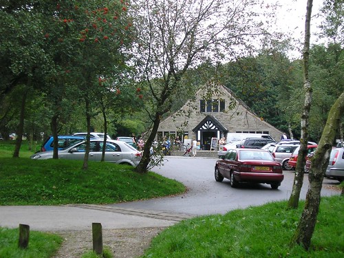
This part of the Lancashire Trail took us from Rivington to Abbey Village. Descending from Lower Barn back onto the footpath along Rivington Reservoir we turned right and walked to Horrobin Lane, the road that crosses the Reservoir.
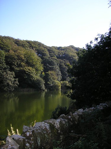
Turning left, and crossing the road, we then turned right along a road with the reservoir on our left. Further along this lane we bear left along a stony track which ascends along the left side of the Yarrow Reservoir. Halfway up this path forks and we bear left to descend a winding path to a road and bridge beside Anglezarke Reservoir. Here we turned right and walked along the pavement to a road junction.

Butterflies basked in the sun on the reservoir walls. At the junction we kept to the left and left the main road after a short distance (car park entrance) to continue ahead with Anglezarke Reservoir on our left.

After about a half a mile, we ascended an embankment passing High Bullough Reservoir on our right.
Follow the path down to a kissing gate and continue on a track to a stile on the other side of woodland. This leads to a field which you cross on a clear narrow path with Anglezarke Reservoir on the left. Don’t be tempted to follow the footpath sign off to the right.
Cross a stile onto a bracken lined path, through trees, this in turn leads to another stile and a road.
Proceed diagonally left across the road through a kissing gate and follow the track to White Coppice with its cricket field and small reservoirs.
With these on your left continue ahead on a clear path, which veers right as it climbs steeply up the hillside from White Coppice.
At a fork in the path turn right, still ascending a steep, rutted path, heading towards Great Hill.
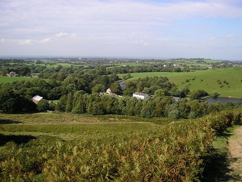
Continue on a narrow, but clear, path passing several ruined farmsteads and a coppice to eventually arrive on Great Hill (1200 ft); here, at the summit, there is a 4-way wind shelter. Follow the sign towards Darwin Tower, which can be seen in the distance. Look out for, and follow, a less clear path on the left, as you near the bottom of the valley. This leads you through another ruined farmstead; follow the path down hill, with the stream first on the left then on the right. The path turns into a stony track that continues to follow the stream to a small bridge on the A675. Cross the road turning left, taking a public footpath, turning right, into the woods.
Cross a small stream and turn sharp left to follow the lower of two tracks alongside the stream. The path climbs to the right onto a stony track that continues to follow the stream to a bridge.
Cross the bridge, turning right through a kissing gate and proceed with the stream on your right. After steps (up and down) take a track to the left away from the stream; this passes through a wood to a road from the dam of the reservoir on the right.
Follow this road and where it turns left continue along a path ahead to another reservoir. Follow the path, with the reservoir on your right, to a footbridge. Cross the bridge and turn left along a track. Cross another footbridge over the spillway, from the reservoir. Just before the house turn right up a narrow path onto the service road. Turn right and follow the road to the Hare & Hounds at Abbey Village.

Another nine mils completed! The two pints was well received and finished off what was a very nice walk indeed.
No comments:
Post a Comment