Tuesday, March 25, 2008

Maps for the last two walks

  1. Maps for the Easter Sunday walk, Thurstaston and Caldy can be found at http://www.gmap-pedometer.com/?r=1727900 (6.9549 miles, a bit further than I thought) and
  2. Maps for the Holywell walk can be found at http://www.gmap-pedometer.com/?r=1708302 (4.3036 miles)
If you follow our footsteps then, I hope you enjoy them both we did.
Blogged with the Flock Browser

Easter Sunday stroll on the Wirral

A change from the big skies of our pub-strolls of the last few weeks. A walk along the opposite side of the Dee with the Ravine and waterfalls of "The Dungeon", St Bartholomew's Church...
St Bartholomew's Church - red sandstone
...and the battlemented tower in its churchyard...
Battlemented Tower
woodland and common of Thurstaston Common, and generally outstanding scenery. This also included fine views across the Dee like this one towards Hillborough Island.
Hillborough Island
This was a revisited walk; our last visit was on the 2nd May 2004! Looking at the notes I made then we apparently got lost and "the last bit along the Wirral Way a bit tedious". We didn't get lost this time and sadly the tedium was still present on the last stretch.
Toasted sandwiches, Cheese and ham for me and cheese and tomato for Chris, finished off a very enjoyable 6.5 mile walk. Sadly the football result later that day wasn't so good; Liverpool lost to Man U.
Blogged with the Flock Browser

Holywell - Basingwerk Abbey - St Winefride's Well

Last weeks walk took us to Wales; just shows that we English don't hold a grudge (Wales had just won the Rugby 6 Nations Grand Slam)
Although the main attractions didn't open until Easter, the walk was an interesting one. Apparently the monks of Basingwerk Abbey...

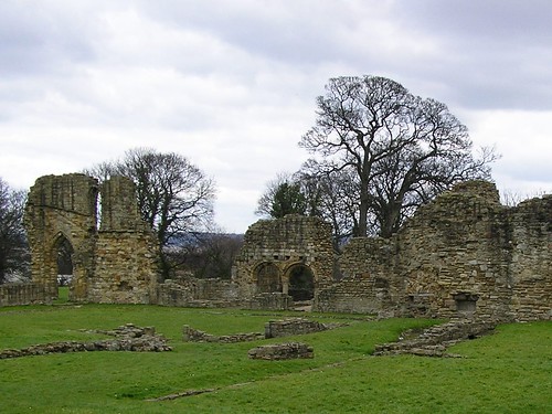
...were the first to exploit the power of the stream and their lay successors, in the 18th century, built copper works and cotton mills.
Our walk took us past tiered mill ponds with the usual cormorants...
Bull Rushes and cormorants

and interesting sculptures like the bull rushes above and the three little pigs at the start of the walk.
Three little pigs
The power of the water can be seen in the picture below where the open grid walkway crosses a mill-race...
Chris's favourite part of the walk
The walk took us to the main attraction of the walk. From 600 AD the well of St Winefride was an object of veneration. Passing the many remains of past industries and water 'features'...
Mill pond and overflow
...we eventually arrived.
Jousting Tents?
Chris noted the 'Jousting tents' which we later realised were changing tents for those who wished to bathe in the 'waters'.
We were made aware of the story of how Winefride was beheaded by a chieftain whose attentions she refused and whose head was miraculously restored, in the exhibition room attached to the shop/entrance. It was one of the most important shrines in Britain and known as the 'Lourdes of Wales'
The well itself is impressive with water rising in the centre...
St Winefride's Well
Sadly there was 'No Bathing Today'; On a cold spring day a dip was just what Chris and I was looking for.
We decided to make our way back along the old railway line to the Dee estuary.
Unfortunately the old track was overgrown and we had to retrace our steps to leave the 'Greenfield Valley' via the carved entrance...
Impressive carving
A walk along the road to the Dee took us past Welsh Police confiscating motorbikes from 'children'; other bikes appeared as soon as the police had gone.
Tide out, local fishing boats were stranded on the beach...
River Dee - low tide
There was a dark side to this valley which I'm sure the Welsh would prefer to dismiss; earlier industrial works concentrated on the treatment of copper for various uses, some of the pots and pans exported through Liverpool to exchange for West African slaves.
The real down side was our visit to the local pub! Rude staff told us in no uncertain way that food wasn't available; the beer wasn't good and the fabric 'worn' to say the least.
Well worth a return visit but we will take our own refreshments.
Blogged with the Flock Browser

Saturday, March 15, 2008

Legh Arms, Mere Brow

I thought I'd better try to do last week's pub stroll before we set off on this week's walk. The one thing that sticks in my mind was the cold wind and exposed landscape. The Golden man was the first unavoidable landmark...
statue of golden man on a low loader
...as he was on a low-loader we were not sure he was visiting or had just arrived! He was, without argument, impressive.
We made our way past the golden man through Leisure Lakes, a 30-acre lake, 4ft 6in deep, sandy beaches, picnic park, walks, landscaped touring caravan park with 90 pitches available. Golf Driving range, 9-hole golf course, jet ski centre, mountain bike, fishing and paintball. Western themed pub on site, paintball games for groups. The latter was well subscribed for a Sunday morning in March.
The walk was uneventful, passing a few other walkers and riders (horse and cycles). Irrigation reservoirs, with what appears to be the compulsory cormorant, were passed at relatively frequent intervals.
Low slung cormorant in irragation reservoir
Green Plovers, with their manic flight patterns, and skylarks added to the long and far from winding roads and, as we headed back towards Mere Brow, the March lambs in red-jackets were possibly the highlight of the walk.
red jackets for small lambs!
The 7.4062 miles started and ended at the Legh Arms
Legh Arms at Mere Brow
and for those of you who wish to do the stroll you can view the map at http://www.gmap-pedometer.com/?r=1701272.
Food and beer both excellent; maybe a Wednesday night visit is called for.

PS Sorry I didn't include a map for last week! you can view it at http://www.gmap-pedometer.com/?r=1667526.
Blogged with the Flock Browser

Sunday, March 02, 2008

The Ship Inn Burscough - New Lane - Martin Mere - Tarlscough - The Ship Inn

Big skies cold winds and an 8.765 mile walk...
Starting from the Ship Inn next to the Rufford Branch of the Leeds-Liverpool Canal...
Known locally as the
We headed up to the main canal and, passing the 'dry-dock' we headed towards Liverpool. The old Ordnance Stores, with the many rabbits, are long gone; replaced by modern houses overlooking the canal. A relatively quiet stroll into a cold wind, took us past Sunday Footballers and past the Lathom Slipway pub; no we didn't stop. Glimpses of the new 'hide' at Martin Mere  were caught as we crossed the Southport-Wigan railway line for the first time...
Looking towards Southport
I took us slightly off the proper path but looking back, when we got back on track, we avoided lots of wet field! Good move!
Back across the line at New Lane Station, I had to do a quick detour as the gates descended to stop the no-existent traffic.
We walked parallel to the railway before crossing a third time, with views of the Mere and Windmill farm in the distance...
The dots are Green Plovers...
The new hide at Martin Mere has resulted in a re-route of the footpath; no further and enabled us to observe hares in the sun along with cormorants flying up from the mere.
Apparently an owl had accidentally dropped this resting mouse...
Dropped by an owl?
... and couldn't find it in the dark (I wont say who's theory that is!)
Swans passed overhead as we continued on our way...
Fly pass..
...and Hawaiian Geese,
Hawaiian Geese
...Guinea Fowl and a Peacock...
Guinea Fowl & Peacock
were also spotted on the way...
Ready for a pint we ended back at the Ship Inn and enjoyed two pints of Bombardier; Mmmmm!

Refered to as the 'Blood Bucket'

Blogged with Flock