
The End!
A grand total of 48.3605 miles through the Pennines - THE BRONTE WAY- including a detour to Top Withens (Wuthering Heights)
Having used the Paul Hannon Giide, I see little point in rewriting what is already an excellent guide. (£4:50 ISBN 1-870141-56-3 Publisher Hillside)
We walked for five days.
Day 1 started at Oakwell Hall...
...and headed for Shelf (10.8021 miles) This included a brief visit to Red House
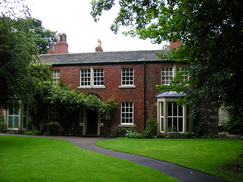
...that featured as Briarmains in Shirley and Clough House to which Patrick Bronte came after his marriage to Maria Branwell in 1812...
The map of our first days walk can be viewed at http://www.gmap-pedometer.com/?r=1180889
Day 2 - from Shelf to Wycoller (11.6753 miles)
This included visiting...
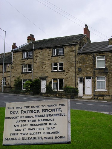
...the remains of the Bell Chapel (1612); the parish church when the Rev Patrick Bronte came from Hartshead in 1815.
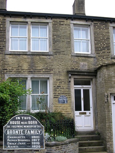
Above is where they lived; now numbers 72 and 74
The map of our second days walk can be viewed at http://www.gmap-pedometer.com/?r=1178829
Day 3 was a day of rest where we revisited Oakwell Hall, and the Red House; Ponden Mill was also visited for a snack and general 'nose'.
Day 4 was Haworth to Wycoller
We set off from our hotel...
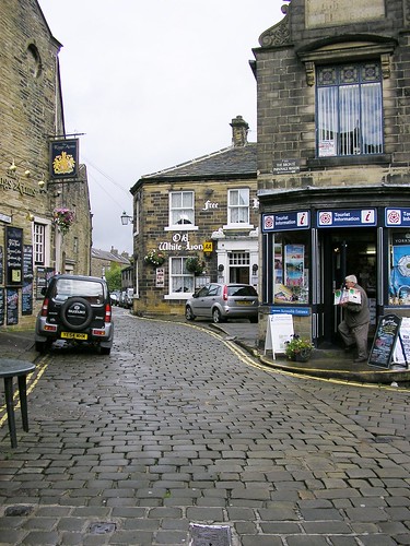
...The Old White Lion situated at the top of Haworth High Street which was steep, and cobbled;
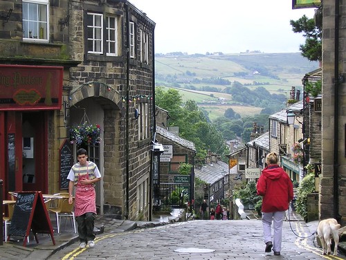
...making the hills in San Francisco quite insignificant!
Visiting...
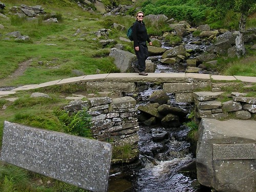
Bronte Bridge and Bronte Falls (almost missed them as they were small to say the least) on our way to Top Withens...
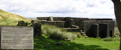
...the inspiration for Wuthering Heights. Next we passed...
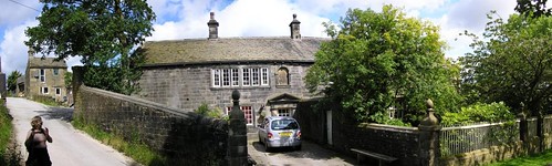
Ponden Hall where Emily visited the Heaton family; portrayed the house as Thrushcross Grange, the Linton home in Wuthering Heights. Eventually we arrived at what remains of...

Wycoller Hall, a 16th century country house. It is thought to have been the Ferndean Manor of Charlotte's Jane Eyre.
The map of our third days walk can be viewed at http://www.gmap-pedometer.com/?r=1178717
Day Five we split up the last section into two parts; today we walked from Wycoller to a carpark next to the River Brun after which Burnley got its name.
We decided to give bothLumb Spout and Boulsworth Hill a miss (we had seen and walked to and up onto on previous walks; they were optional detours) We could see, for most of the first part of the walk...
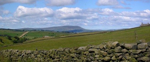
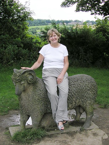
Pendle Hill; Melanie will remember it as being far too steep, Ben because he insisted on bringing down a large stone which he painted sheep on. Chris and i because it was part of the Lancashire Trail among other walks.
We had lunch beside Thursden Brook a lovely setting, next to a footbridge...
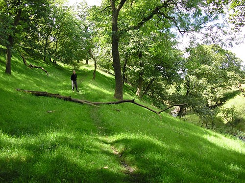
No real Bronte influence today just wild and beautiful countryside.
The map of our fourth days walk can be viewed at http://www.gmap-pedometer.com/?r=1180745
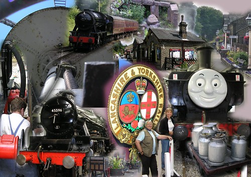
Day 6 - We explored the "Bronte Haworth"
and played at "Railway Children"
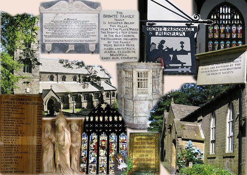
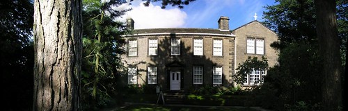
The Bronte Parsonage Museum, home for the Brontes from 1820 to 1861, is well worth a visit...
Day 7: The final walk
From the River Brunt to Gawthorpe Hall
Considering how close we were to a very large population the urban effects were minimal.
The...
Leeds and Liverpool Canal passing...
Byerden Holme eventually brought us to the end of a truly spectacular walk. We were luck with the weather, the hotel, food, drink, wildlife (flora and fauna), and the Bronte family.
The map of our fifth days walk can be viewed at http://www.gmap-pedometer.com/?r=1190177
- A slideshow of 54 photographs taken during our walk along the Bronte Way, can be viewed at http://www.flickr.com/photos/acljohn/sets/72157601024225310/ showing a much wider range than I've included in this blog.
Blogged with Flock
1 comment:
I have a website on Wuthering Heights (www.wuthering-heights.co.uk) and I am looking for a photograph of the Bronte birthplace at Thornton to display on it. Would you be interested in allowing me to use the picture from 1 August 2007 blog (with whatever acknowledgement you wanted)? I can be contacted at the website.
Post a Comment