Monday, August 13, 2007

Pennington Flash

Last Sunday we decided to re-visit Pennington Flash; a short walk to 'break-in' my new walking boots. The last time we visited we were doing the RSPB bird watch (February'ish); we think it was probably 2years ago.
Carvings were the main highlight of this particular walk...

The kingfisher was the first one we spotted but...

...made Chris jump as she spotted it out of the corner of her eye as we headed towards a hide.

and...

...were two others found on the walk.
The Flash was formed by mining subsidence; the vast amounts of coal extracted by local collieries (all now closed) eventually caused the land to sink and by 1905 a large lake had formed. The Flash was larger than it is today. It was partly filled with colliery waste creating the spoil heap between the Flash and the Leeds & Liverpool Canal, known as Ramsdale's Ruck.
The southern part of the Flash was filled with 'domestic waste' to prevent the regular flooding of St Helens Road.

During the 1960's and 70's ideas for developing the site for recreation and conservation began to emerge and in 1981 Pennington Flash Country Park was officially opened.

Blogged with Flock

Wednesday, August 01, 2007

Done and dusted!


The End!
A grand total of 48.3605 miles through the Pennines - THE BRONTE WAY- including a detour to Top Withens (Wuthering Heights)
Having used the Paul Hannon Giide, I see little point in rewriting what is already an excellent guide. (£4:50 ISBN 1-870141-56-3 Publisher Hillside)
We walked for five days.
Day 1 started at Oakwell Hall...

...and headed for Shelf (10.8021 miles) This included a brief visit to Red House

...that featured as Briarmains in Shirley and Clough House to which Patrick Bronte came after his marriage to Maria Branwell in 1812...

The map of our first days walk can be viewed at http://www.gmap-pedometer.com/?r=1180889
Day 2 - from Shelf to Wycoller (11.6753 miles)
This included visiting...

...the remains of the Bell Chapel (1612); the parish church when the Rev Patrick Bronte came from Hartshead in 1815.

Above is where they lived; now numbers 72 and 74
The map of our second days walk can be viewed at http://www.gmap-pedometer.com/?r=1178829
Day 3 was a day of rest where we revisited Oakwell Hall, and the Red House; Ponden Mill was also visited for a snack and general 'nose'.
Day 4 was Haworth to Wycoller
We set off from our hotel...

...The Old White Lion situated at the top of Haworth High Street which was steep, and cobbled;

...making the hills in San Francisco quite insignificant!
Visiting...


Bronte Bridge and Bronte Falls (almost missed them as they were small to say the least) on our way to Top Withens...

...the inspiration for Wuthering Heights. Next we passed...

Ponden Hall where Emily visited the Heaton family; portrayed the house as Thrushcross Grange, the Linton home in Wuthering Heights. Eventually we arrived at what remains of...

Wycoller Hall, a 16th century country house. It is thought to have been the Ferndean Manor of Charlotte's Jane Eyre.
The map of our third days walk can be viewed at http://www.gmap-pedometer.com/?r=1178717
Day Five we split up the last section into two parts; today we walked from Wycoller to a carpark next to the River Brun after which Burnley got its name.
We decided to give bothLumb Spout and Boulsworth Hill a miss (we had seen and walked to and up onto on previous walks; they were optional detours) We could see, for most of the first part of the walk...

Pendle Hill; Melanie will remember it as being far too steep, Ben because he insisted on bringing down a large stone which he painted sheep on. Chris and i because it was part of the Lancashire Trail among other walks.
We had lunch beside Thursden Brook a lovely setting, next to a footbridge...

No real Bronte influence today just wild and beautiful countryside.
The map of our fourth days walk can be viewed at http://www.gmap-pedometer.com/?r=1180745
Day 6 - We explored the "Bronte Haworth"

and played at "Railway Children"


The Bronte Parsonage Museum, home for the Brontes from 1820 to 1861, is well worth a visit...

Day 7: The final walk
From the River Brunt to Gawthorpe Hall
Considering how close we were to a very large population the urban effects were minimal.
The...

Leeds and Liverpool Canal passing...

Byerden Holme eventually brought us to the end of a truly spectacular walk. We were luck with the weather, the hotel, food, drink, wildlife (flora and fauna), and the Bronte family.
The map of our fifth days walk can be viewed at http://www.gmap-pedometer.com/?r=1190177
All good things come to an end and Chris is back in work tomorrow and I'm back on Monday.

Blogged with Flock

Sunday, July 22, 2007

Tawd Valley Park


Running through the heart of Skelmersdale. Tawd Valley Park follows the course of the River Tawd through open meadow and woodlands.
I didn't take a picture of the Bandstand, just beyond the Concourse, although I was tempted to get the camera out, if only to show the disgraceful state it is in.This end of the Valley Trailwas in great need of care and attention; it had been impressive once upon a time but... it is very sad to see now.
Signs, if they ever existed, had been damaged, removed, burnt or, as suggested were never there. Once away from the Concourse (Shopping/swimming pool/library/walk-in NHS/ etc.), we could enjoy the open spaces and take a relaxing walk on a Sunday in the sun. Yes I did say sun! Litter was no longer apparent and we walked through the first part of the park, called Wildlife on your Doorstep. A route through an area of natural beauty rich in a wide variety of trees, wildflowers, butterflies, squirrels (1) and birds.
The second part, Heritage of the Tawd, took us through the recent history of the valley; remains/features left over from the mining and cotton industries which helped develop Skem.

As you can see from the image, Chris decided to check my Physics knowledge; I said it is deeper than it looks, she tested it and who was correct? I rest my case...
A detour had to be made on the loop back as a complete bridge (not the only one) was missing (hence the wet foot). This far end is entitled Geological Discovery but why we are not sure. The woodland, at the back of Our Lady Queen of Peace High School and Lathom High School, is a disgrace! the amount of litter, broken bottles, cans etc., unbelievable. I'll let you draw your own conclusions about why this area in particular was so bad.

Just a bit further on from the waterfall another bridge had been destroyed so a detour up onto Glenburn Road was needed before we could make our way back to the start.
Apart form the two areas mentioned the walk was enjoyable; open spaces, lots of flora and fauna and the noise of running water. That plus sunshine and a quick visit to Martin Mere for food and drinks (Chris hoped to see the beavers) completed another pleasant walk in Lancashire.
The route taken can be seen at http://www.gmap-pedometer.com/?r=1159969

Blogged with Flock

Tuesday, July 17, 2007

They let him loose with a paintbrush!

Just a brief update for the rest of the family: Ben has been helping the Humane Society Silicon Valley!

You can read all about it at http://hssv.org/volunteer_corp_yahoo.html
No he didn't smuggle a pet home!

Blogged with Flock

Sunday, July 15, 2007

Birkenhead Park Map

As usual, for those who wish to do the walk or would like to see where we went, go to http://quikmaps.com/show/38599

Blogged with Flock

Birkenhead Park and Oxton Circular


A day of feathered friends and squirrels! Through the Wallasey tunnel, £1.30 these days, and parked in Ashville Road between the lower and upper Park.The first wildlife were squirrels spotted by Chris as we walked around the first lake. The geese, see above, were cropping the banks of the lake and, apart from an initial interest to see if we had bread, were not bothered by our presence in any way. Further on we were greeted by a variety of ducks and their young...

Convinced we did have food. The ducklings left positive bow waves as they dashed across the lake. Chris kept telling them we didn't have anything for them (as if they understood!)Back onto the perimeter road to the gates between Kemp's House (whoever Kemp was/is!) and the Castellated lodge. The next part was surprisingly rural, eventually crossing Wirral Ladies Golf Course (I'll resist any comments) and onwards to Storeton Ridge. The views were surposed to be of the "Wirral Peninsula and the Dee Estuary over to the hills of North Wales". Perhaps in winter this may be the case but at this time of year the hedges/trees etc blocked any view.Down through modern housing we then headed back up the hill to get confused by the written directions (outside St Saviour's Church). The problem was, the writer of the guide gave the wrong name for the road! Very annoying! That sorted we went on our way through Oxton Village, which is a conservation area; disappointing as again the write-up suggested it would be more impressive than it was. Perhaps we are getting too critical, having seen so many nice villages/conservation areas. Don't get me wrong, there are some wonderful buildings along the walk but many are looking 'tired'. Down Christchurch Road past

Christ Church, on our right; in the distance Chris spotted St John's Tower (Liverpool); if you look carefully you will see it on the horizon.The next port of call was the Williamson Art Gallery; not been before and well worth a visit. On permanent display are Victorian oil paintings, English watercolours, Liverpool Porcelain and Della Robbia Pottery. A range of collections: from local history and ship models to fine decorative arts, part of the Merseyside Embroidery Trail and a display of wildlife photography were the highlights

Back into Birkenhead Park, via the gate next to the Italian Lodge, we passed the wildlife pond and went around the lower lake with views of the Swiss bridge...

and the boat house...

Squirrels and pigeons, which for some reason Chris kept calling penguins, competed for bread...

...and generally kept us amused until we reached the new "Visitors' Pavilion" with their formal gardens...

They reminded me of the Abbey Gardens in Bury St Edmunds (My home Town!) After a drink in the pavilion (Chris also had toasted tea-cakes) we headed back to the car and home.The walk made me realise how wealthy the area had been in the past and it was nice to see attempts to revitalise the park. Many of the 'mansions' were now converted into flats and, as I've already said, many of what were fine buildings were looking tired!

Thursday, July 12, 2007

Post2Blog3

Today I’ve looked at this WYSIWYG (what you see is what you get) blog editor; apparently it used to cost about £20 but now is absolutely FREE!

So far it has been easy to use and the keyboard shortcuts for Microsoft(c) Word all appear to work (I haven’t tried them all yet!) There are some handy features...

  • Clicking the Advanced icon provides extra tools including bullets

  • a live spell-checker

  • a toolbar for Microsoft Word and

  • add-ons for Internet Explorer and Firefox.
I’m impressed so far and if you are reading this, my first blog using Post2Blog - a desktop blogging client for Windows. This is an example of quick snippet that inserts link to Post2Blog and text if you type "Post2Blog". To disable this quick snippet just remove it via "Tools" | "Manage Quick Snippets". 3.01 has worked.

PS you can download it, if you wish, from http://bytescout.com

Sunday, July 08, 2007

Crowden and Torside Reservoir Walk: Map and Images

For the map of the walk visit http://quikmaps.com/show/38217
I must say, especially after all the rain we have had, that the engineering skills of the Victorians is most impressive...

1 Weir at lower end of Torside Reservoir

2 Weir at lower end of Woodhead Reservoir

3 Second weir at the lower end of Woodhead Reservoir

The plants were also impressive

1 Orchids on the Trans Pennine Trail...

2 Cones on conifers (where else would you find them?) in woods after crossing the B6105

On the way home we stopped to look at a Well Dressing

1 The complete dressing...

2 A close up

Blogged with Flock

Return to Crowden!

Today we returned to Crowden which was the walk recorded in our first ever Blog last year! On looking again the date said 31 August when in fact it was 31 July!! We had found wild cherry trees and had decided to return this year armed with bags in order to collect more than my tummy could hold. However, as all best laid plans it was not to be. Firstly the relevant section of the path was closed for repair work and secondly the couple of trees that we did find had cherries but not ripe ones! This disappointment was somewhat balanced by the array of purple orchids which J photographed and will hopefully add. (added)

It has been a wet week again but we just about managed to dodge the showers today. We went to the Hare & Hounds on Wednesday for our ‘free meal’ after the last troublesome visit. The food was OK this time but the truculent waitress left a lot to be desired when she informed us that our food had been ready for ages but she didn’t know where we were sitting!

We went to the Everyman on Thursday with Mel to see The Cruel Sea. This was a play built up from interviews with Liverpool sailors from the Merchant Navy who had kept the supply lines open during the Second World War at great risk to themselves. It was good but the actual interviews which formed part of the dialogue were difficult to understand which was a pity. It had been put together by the same man who did Unprotected which was about Liverpool prostitutes and was much better in my opinion!

Saturday, July 07, 2007

And now for something completely different!

Well you may find that there isn't anything worth watching on TV tonight! If so why not go to http://www.mogulus.com/locus and watch my TV channel (RSC Northwest)
It is experimental at the moment but we currently have a 'storyboard' of 5 video clips
  1. Liverpool Meeting May 2007
  2. RSS in Plain English
  3. All about the RSC-Northwest
  4. Wikis in Plain English
  5. Social Networking in Plain English
Currently running on Auto-pilot.
The plan is...
...to produce videos of events and/or training
...to show them...
...as a loop and/or
...live (scarry)
so that managers, administrators, eGuides, practitioners etc., who are unable to attend face-to-face events, will be able to experience martini learning (any time, any place...)
If the scrip works you should be able to see the TV channel below! Enjoy...


Blogged with Flock

Sunday, July 01, 2007

Maghull, Sefton and the Mersey Forest

No travelling today, we decided, especially looking at the weather, to stay close to home. So down to Maghull Station and off along the Canal (Leeds And Liverpool) towards Aintree.

Apparently Maghull is listed in the Domesday Book, its name of Anglo-Saxon origin meaning a corner of land where mayweed grows (Chamomile).

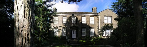
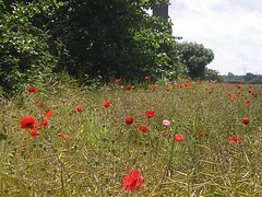
Along Brewers Lane, the back way to Melanies, and up the lane through Wood Hall Farm. built in the late 17th Century. Between the farm and the underpass beneath the railway we saw lots of poppies among the oilseed rape...

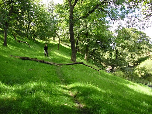
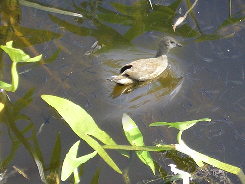
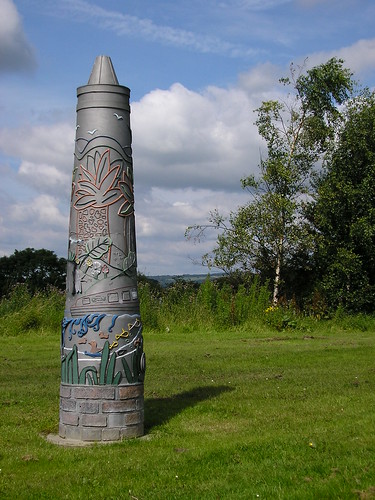
Under the railway and over the M58 we eventually arrived at the new crossing on the A59. Instead of our usual route over the bridge, we went under it and onwards for about 500m beside the River Alt. Crossing the bridge into the Mersey Forest, we turned left and headed along the opposite bank of the river towards Sefton Village. We kept our eyes open for the 'Owl Statue' as we walked.

We saw the 'Owl'; the forest is growing quite rapidly and it isn't going to be long before he/she can't be seen from the road or various paths; he/she will only be visible in their clearing among the trees.

Cinnabar Moth Catterpillers were visible in large numbers although very small at this time of the year...

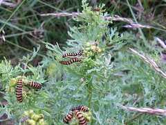
Its is wonderful how these prison clad caterpillers turn into such bright moths

http://www.ukmoths.force9.co.uk/Cinnabar070798.JPG

As we have already mentioned the origin of the name Maghull, Sefton means 'a farmstead where rushes grow'. It predates the Domesday book and has a 14th Century church, St Helen's, a Grade II listed building.

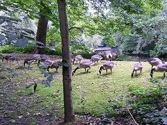
Down the path we used two years ago to collect elderberries for wine, we entered the Mersey Forest again and returned back to the banks of the River Alt. Oyster catchers greeted us, three of them, as did the rain; we had already got wet from the long grass, now it rained. Up to Showrick Bridge, Chris wanted to cross it, we walked away from the river and around to Moor Lane. At the second path off to the left we were expecting to see a 'wooden sculpture of a hare'...

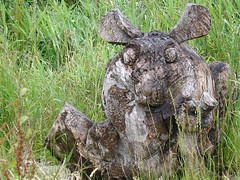
Anything less like a hare I have yet to see; the long tail wound around a 'stem', and the shape of the ears was enough to confirm it was a mouse!

We made our way along side Roughley's Wood and up onto the embankment beside Harrison's Brook. We rejoined the path (past the elderberry bushes) and on reaching the road looked for and found the capped well of St Helens...

Homeward bound now, we re-passed the Punch Bowl (remember working there Ben?) St Helen's Church and re-entered the Mersey Forest again. Making our way across the forest we ended up walking on an enclosed path across the back of Maghull High Playing Fields; out onto Ormonde Drive and around the corner to the Meadows pub.

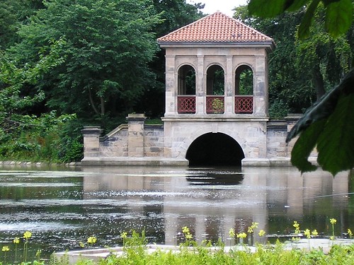
Passing through the impressive gates into King George Field, we crossed behind the Town Hall, up the steps onto the A59 and then back down onto the Leeds and Liverpool Canal bank.

We made our way back to Maghull Station and home!

By the way, the Boat yard looks very smart now with new windows etc. I know, it wasn't to be!

An easy walk on level ground, no stiles; pity about the odd shower! Quickmap available at http://quikmaps.com/show/37762

technorati tags:, , , , ,

Blogged with Flock