Sunday, October 26, 2008

Goosnargh & Chingle Hall

The name of the village tells us something of its origins, for it is a mix of an Old Scandanavian word 'erg' (a summer pasture) and an Old Irish personal name (Gussan). It is possible that Norse settlers in Ireland later moved here, a theory that has some tentative backing as it is said that the original structure of Chingle Hall included beams from Viking longships.
The hall, built in 1620, is also reputed to be the oldest brick house in Britain. If you look it up on the internet you will discover that with its 16 spirits it is also the most haunted house in Britain.
The village has a speciality dish, Goosnargh cakes, a shortbread with caraway seeds. The walk started at the mediaeval church, St Mary's. The walk also goes along the drive of what was a huge mental institution, Whittingham Hospital, now closed.
The guide, from Walking World, tells us that "The village name is used by Douglas Adams twice in his books: once as a Betelgeusian word used by Ford Prefect 'when he knew that he should say something but he didn't know what it should be' and again in his dictionary 'The meaning of Liff' where a Goosnargh is defined as 'something left over from preparing or eating a meal, which you store in the fridge despite the fact that you know full well that you will never use it'.
The walk, although very enjoyable, was very boggy in places and there were some electric fences to negotiate. Chris wasn't impressed by the number of fields with cows and 'Bulls'. One of the highlights of the walk was the herd of deer, shown in the picture below...
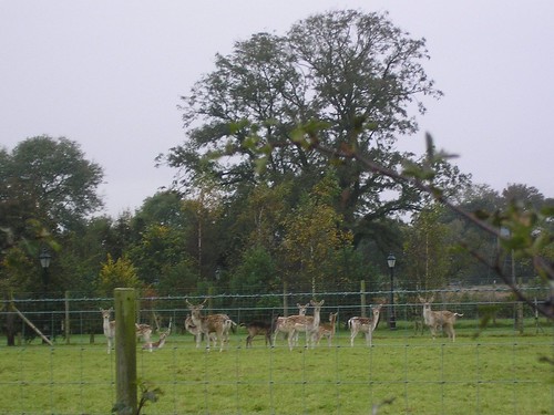
Deer just before Chingle Hall
You can view our 5.8206 mile walk at http://www.gmap-pedometer.com/?r=2335362.
Blogged with the Flock Browser
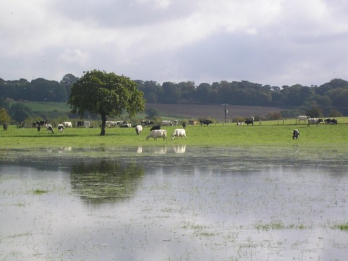
Kingsley - Bradley Orchard - River Weaver - Kingsley

Leaving Kingsley village, we soon emerged into a countryside of fields and narrow, wooded valleys. The steep-sided valleys are known as 'cloughs' in this area of Cheshire. The fruits and seeds add colour to the walk and providing rich pickings for the birds (We were lucky to see a lesser spotted wood pecker). Eventually our route passed along the top of a gentle slope running down to the river. From this terrace edge there were views downstream towards the Mersey and upstream towards the Pennines. There were occasional glimpses of the factories towards Runcorn. Leaving the terrace for the riverside, we crossed water meadows.
Water meadows
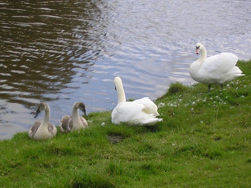
Beside the river there were swans,
Weaver Swans
geese, ducks, moorhens and coots. The riverside path ran though relatively undisturbed woods that provide good cover for small animals; eventually the route left the river valley with new views opening up towards the Sandstone Ridge to the west.
The area was extremely peaceful and the guide, from Walking World excellent (What a contrast from the previous week.
 You can view our 6.1324 mile walk at http://www.gmap-pedometer.com/?r=2335303.
Blogged with the Flock Browser
And it all started so well...

Readers of my blog will know that I'm less than happy with Ron Freethy's Riverside Rambles along the Mersey as either the maps and/or the directions have been found to be lacking. However, having paid £8.95 for the book, I'm reluctant to bin it! So what did we do? We tried another walk. Foolish, as we discovered.
The walk (Walk 15: Moses Gate - Three Waters and two parks) is excellent but the map and directions have little relation to the 'real-world'; perhaps it's a Second-life walk?
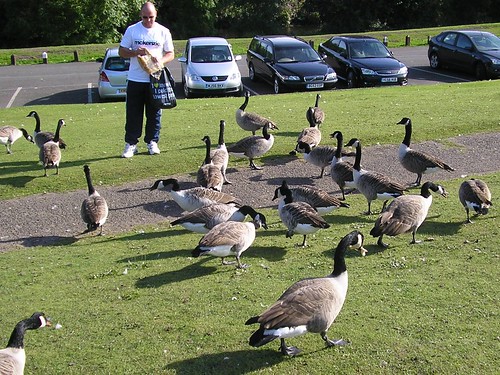
Moses Gate with the large flocks of geese...
Moses Gate Geese
...was a very pleasant start and, as you can see from the photograph, the sunshine was an added bonus. Thank goodness I'd brought a map with me. The Country Park consists of 750 acres of "Urban Countryside", unfortunately the Warden Service and Information Service, located in Rock Hall was closed! Useful on what is probably one to the two busiest days (the weekend!) Note the map in the book, places the start of the walk in totally the wrong place! Take a look at the 6.594 mile walk at http://www.gmap-pedometer.com/?r=2335240. I wont go into great detail about the inaccuracies of the guide but we walked nearer 9 miles and residents, when asked for assistance couldn't help us. The map I've provided is the walk and not our wanderings!
Walking along the Old Line of the Manchester, Bury & Bolton Canal, once we found it, was a pleasure and Ringley Church with the Packhorse bridge, dating from 1677, opposite was impressive.
Ringley Church
The walk so far had been reasonable with only two detours which I had sorted using my map and a compass.
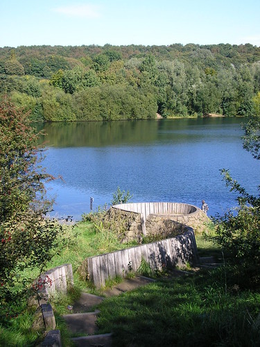
Finding Clifton Country Park and Clifton Bridge were another matter; to be fair, there was alot of building going on and the signs may have been removed but we tried several routes and asked 'locals' with no success. However we did eventually find both. Below is a photograph of Clifton Lake...
Clifton Lake
...dug in the 1960's during the extraction of gravel to build the M62 motorway.
The stone 'sculpture' in the foreground is called Lookout and is by Tim Norris (2001)
We found the Visitor Centre and had a well deserved drink and cake! It was going to be straight forward now surely?
Thank goodness for a good sense of direction, as locals wanted us to go back across the river if we were to "pass the Stoneclough Trading Estate". Instinct helped us find our way back and, on reflection, my bloddy minded determination to complete the walk and a good sense of direction enabled us to succeed.
The question is, do we try another walk from this book?
Blogged with the Flock Browser
Last walk in the Lakes (Monday)

4.3124 miles on Monday morning; you can follow our walk at http://www.gmap-pedometer.com/?r=2332882.
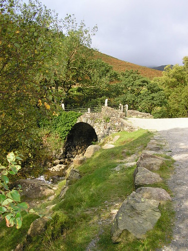
Coppermines to the reservoir of Levers Water. It's all uphill down here! Excellent paths and not too steep, we made our way up one side of the stream passing one of many Shepherd's Bridge.
Shepherd's Bridge
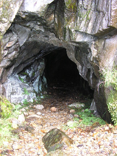
Slag heaps and mine shafts litter the valley...
Mine Shaft
...as well as a well hidden Hydro-electric generator.
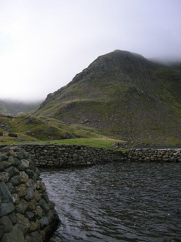
With some discussion about the correct path, we eventually reached Levers water, its depth indicated by the blackness of the water.
Levers Water
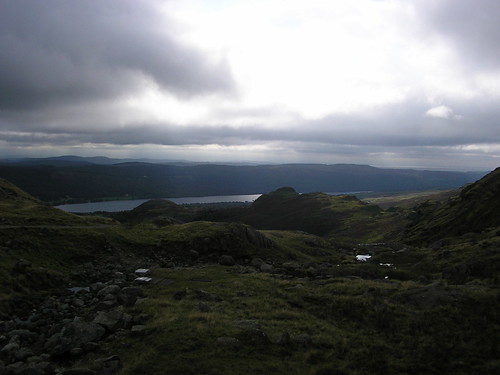
Crossing the 'front' of Levers Water we had to climb a little higher before the walk then descends to join one of the main "Old Man" footpaths, back towards Coniston.
View from the top
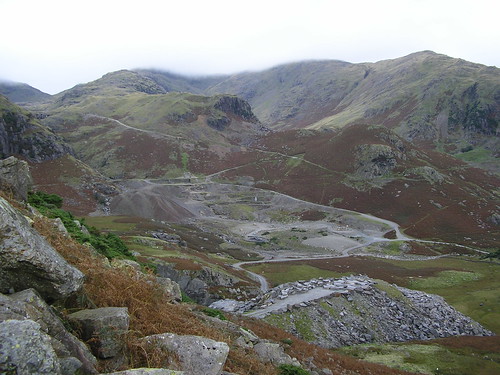
We were now on the opposite side of the stream and passed the slag heaps once more...
Slag heaps
The path we walked up can be seen in the picture above.
In general, an ideal short walk for a morning or afternoon with some splendid views of the surrounding hills.
Blogged with the Flock Browser
Sunday in the Lakes

Still catching up; on the Sunday it was Walk 6 from the same book as the last walk. The map can be seen at http://www.gmap-pedometer.com/?r=2332839. 7.5463 miles from the hotel and back, via Tarn Hows, with a short detour via a National Trust Walled Garden!
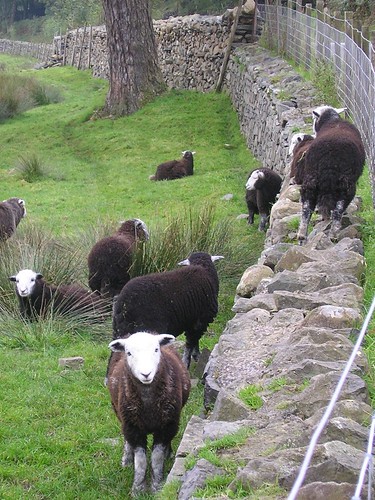
The walk through woodland, running parallel to the main road, was very pleasant with a noticeable presence of water, Herdwick sheep were seen throughout the walk with some experimenting with wall climbing...
Herdwick Sheep
Along the footpath towards Skelwith Bridge & Yew Tree Farm, we eventually reached Tarn Hows via Tom Gill Waterfall.
The reflections on the Tarn were impressive and again the fine weather and clear skys added to our enjoyment...
Tarn Hows from the North end
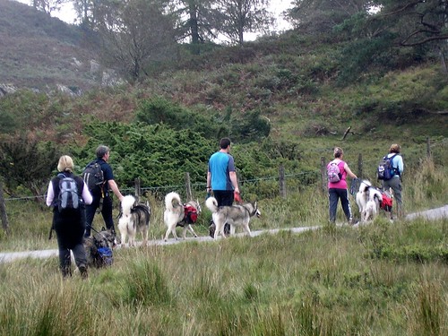
During our break, Husky walkers passed us...
Husky Walkers
Do you like their backpacks?
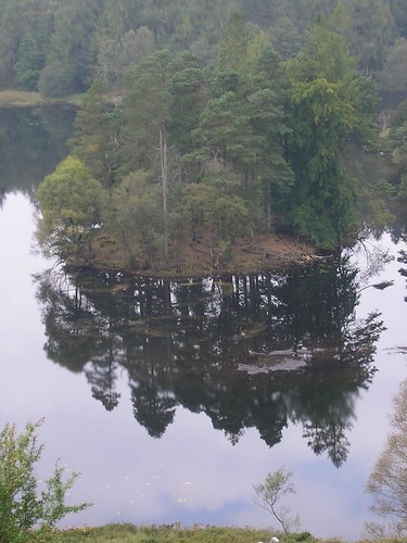
Leaving the Tarn we headed up to higher ground with even mpre impressive views of the reflections...
More reflections
We then spent some time walking through woodland following a stream as it headed towards Coniston Water. The detour to view the walled garden was well worth the extra distance; the photographic journal was impressive, showing just what can be achieved with volunteers.
Back on the walk we headed up hill and through more woodlands before decending to Coniston, briefly joining the Cumbrian Way.
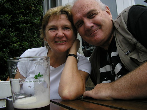
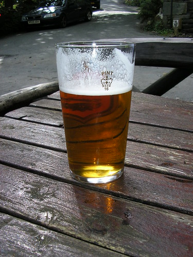
A welcome pint at the Black Bull Inn, a 400 year old coaching inn, which has its own micro brewery on-site, was a welcome end to another enjoyable walk...
Black Bull Pint
Blogged with the Flock Browser
Walking in the Lakes

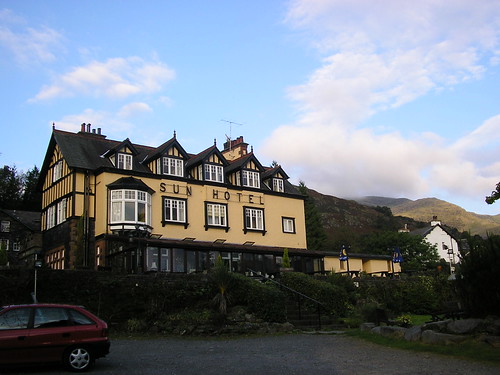
Time for a catch up! Walking hasn't been a problem but writing up the walks has. Chris and I took a long weekend in the lakes and walked on the Saturday, Sunday and Monday morning. Our base was, as can be seen from the photograph below, the Sun Hotel in Coniston.
Sun Hotel Coniston
A 16th Century inn situated on the Walna Scar Road leading to Coniston Old Man. With its exposed beams, flagstone floors and welcoming old range in the fireplace we can honestly say we enjoyed our brief stay. I enjoyed the Coniston Bluebird among many other local and guest ales...
Coniston Bluebird
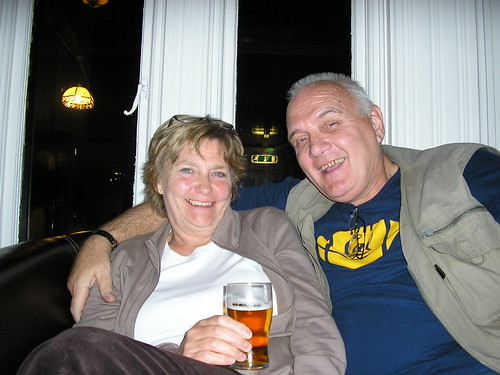
To be fair, so did Chris...
Sun Hotel Guest Lounge
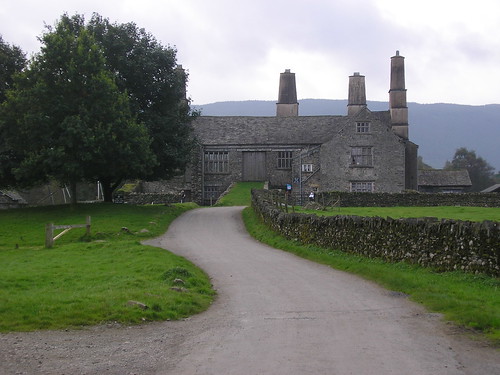
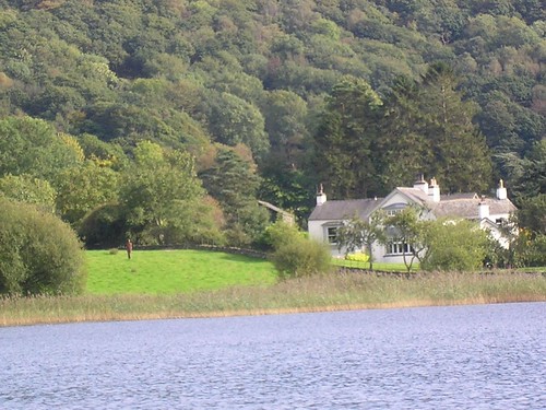
Our first walk, on Saturday, can be viewed at http://www.gmap-pedometer.com/?r=2332762. The guide we used was "Good walk, Good Pub - South Lakes" by Meg Brady. If you decide to purchase it, and I would suggest it's a good buy, the walk is on page 57 and is Walk 5. The only difference was we started and ended at the hotel. The walk along the lakeside was in sunshine and was enjoyable; Coniston Hall, with its grass slope up to the 1st floor and huge chimneys, is impressive and even more so from the water (we had a ferry ride later that day).
Coniston Hall

Apparently chimneys were a status symbol.
A gentle climb through woods, Torver Common, brought home to us the beginnings of Autumn (Fall) with the first signs of leaf changing and fungi showing itself along the way.
We stopped for a snack and a drink, part way up the bridleway to Walna Scar, with fine views across Coniston Water.
Snack Break
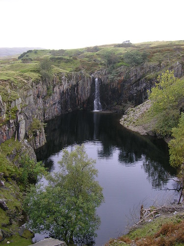
Beyond the climbing hut/cottage, we passed through slate/slag heaps and on to a quite spectacular waterfall into a disused quarry...
Waterfall into the remains of a quarry

Onwards and upwards we eventually joined the wide rocky track of the Walna Scar Road and returned to the hotel. The 6.7021mile walk was, apart from the decent back to the hotel, very enjoyable with fine views and varying scenery.
Later that day we took a ferry ride on Coniston Water which, if you visit the area, is well worth the effort. The commentary was informative, Donal Campbell, water speed records, Swallows and Amazons, Films etc. We also saw one of Anthony Gormley's statues, far from the rest that are on Crosby Beach in Sefton. Apparently it was a gift to a friend who lived at the end of Coniston Water. Can you see it on the lawn?
Anthony Gormley Statue
Blogged with the Flock Browser