The URL for the Warpers Trail is: http://www.gmap-pedometer.com/?r=1034113 This includes the detour which seems to happen more often than not these days; I always get a feeling we have gone wrong so thank goodness it is never far out of our way. Who ever wrote the instructions can't count!
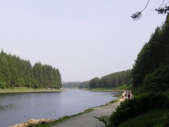
We started the fourth and final part of the Witton Weavers Way at the car park next to Turton & Entwistle reservoir.
Heading back towards the Green Arms Road (B6391) along the right-hand of two gullies (Chris it is "a deep ditch or channel cut in the earth by running water after a prolonged downpour") past a tiny reservoir and up the hillside.
Crossing the road down to the car park we continued up the path, turning right at Green Arms Road and 1st left along a track past Clough House.
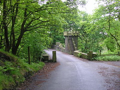
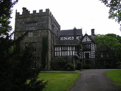
Taking a left we crossed the Blackburn to Bolton Railway line, past an old waterwheel and Turton Tower on our left. For those of you who follow our walks you may remember the bridge...
and the tower...
At the Chapeltown Road we turned left and right past the wartime pillbox; used to protect the largest reservoirs and to keep watch over Horrobin Mill, used for wartime storage.
It was then down through the woods and over the bridge at the end of Jumbles Reservoir
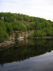
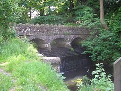
Turning left we followed the reservoir as it narrowed into Bradshaw Brook. We emerged from the woods at Turton Bottoms and crossed a bridge with cobbles on it! I'm not sure what Chris was expecting when I said we would cross the cobbled bridge but it wasn't what I have described!
From 1800 there was much industrial development here including a spinning mill, bleachworks, colliery and stone mill. Turning right, further up the road, we crossed Packhorse bridge with its ford and emerged on another cobbled road.
Turning right down Birches Road we past Printers Cottages on our right and turned left.
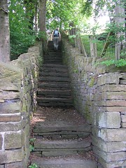
We then turned right through new houses and up steps out of Quarlton Vale.
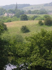
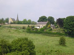
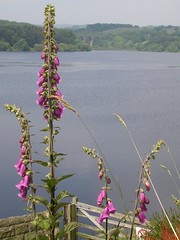
The village we had passed through was one of the most attractive I've seen and the views as we reached the top were impressive as well...
Across several fields, past a waterfall...
we followed the stream. After climbing the hill we crossed a track and walked through the Barlow Institute playground and the bowling green onto the main Bolton Road.
Turning left we headed downhill to the Black Bull Public house. Taking the footpath at the side of the pub, we headed towards Wayoh Reservoir. Climbing the path by the rails we kept near the reservoir to eventually reach Hob Lane.
You may be pleased to know we had taken plenty of water with us today! It was needed with the sun burning down.
Apparently at the second bridge we were to take a narrow path that leaves the main track off to the right. We did, our first mistake! Apparently the writer couldn't count! It was the third bridge; by the time I was positive we had gone wrong our 8.5 mile walk was now going to be 9.75 miles; damn!
We eventually reached Edge Lane, turned right and crossed the railway. The "walker's popular haunt, the Strawbury Duck" was a welcome feeding station; far too much for Chris but I managed and the two pints were very welcome!
We continued along Edge Lane, taking the left of the three forks ending up above Turton & Entwistle reservoir. Directions were not that clear again but without too much trouble we found our way back to the banks of the reservoir.
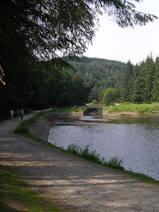
We continued until we approached the end of the reservoir and took the path on our right back to the car park.
Probably the best walk we have done for a long time. The day was too hot for my liking but the walk itself was varied and interesting along its whole length.
So endeth the Witton Weavers Way. What is next?
technorati tags:warpers, trail, Turton, Entwistle, reservoir, Wayoh, Jumbles
Blogged with Flock
No comments:
Post a Comment